The Loop (continued)
Meanwhile, other businesses looked for downtown locations at
reasonable rents. The music industry began to locate in new commercial
buildings going up along Wabash Avenue. By 1891 the W.W. Kimball
Company, maker of organs and pianos, opened its showroom on the
southwest corner of Wabash and Jackson. In 1916 the company built
the sixteen-story Kimball Building on this site; the building
today houses De Paul University's Lewis Center. Across the street
at the northeast corner, where a skating rink had stood, the Lyon
& Healy Company built their new headquarters, also in 1916.
These two companies provided the anchors for Chicago's Music Row,
but other firms located along Wabash Avenue as well. At the very
south end of Music Row stood the landmark Auditorium Building,
linking the cultural institutions of Michigan Avenue with the
music firms on Wabash.
The extension of the elevated trains into the downtown area in
the 1890s reinforced the popular nickname of "the Loop,"
which had originated from the lines of Chicago's once-extensive
cable car system. The trains also lowered land values and rents
on Wabash Avenue. Until the elevated structure was built, Wabash
Avenue merchants claimed that their street would become the retail
center of the city. But once the tracks were constructed and the
noise of the elevated trains began, the dream of challenging State
Street disappeared.
The sixty-year period from about 1880 to 1945 was the Loop's
heyday. All roads led to the downtown area. Chicago's central
business district developed into the
transportation center of Northern Illinois (See Fig. 1).
The various transit lines that linked the city with outlying
areas all converged
on
the Loop. From the horse drawn streetcars, then the cable cars
which appeared in 1881, and finally the trolley cars and elevated
lines connected outlying neighborhoods to the city's center.
Commuter
railroads, like the Illinois Central and the Chicago and North
Western, also converged on the loop. Finally, by the end of the
first decade of the twentieth century, the electric interurban
trains tied Chicago to its satellite cities, Milwaukee, Joliet,
Aurora, Elgin, South Bend, and many others.
This transportation network made the Loop a regional shopping
and business center (See Fig. 2). No
other place could compete with it. The large central business
districts of the
time were made possible by mass transportation systems. The "streetcar
city" presented definite opportunities to the urban dweller.
Retail and other businesses had to locate close to mass transportation
if they were to succeed. Before the streetcar, Chicago was compact
and crowded. With the coming of the streetcar, the middle class
could join the wealthy on the fringes of the city and the outlying
residential neighborhoods began to grow. The Loop lost its
role
as a residential area. The poor and the well-to-do abandoned
the central city as commerce and government expanded. Warehouses
also
replaced the old "Patch" on the south edge of the Loop.
Immigrants flooded the North, South, and West Sides of the city.
By the last decade of the nineteenth century, the new transportation
technology had created a new Chicago and transformed the Loop.
«
previous
8
of 11
next
»
|
 |

|
 |
 
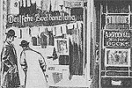
Figure
1: A.
Kroch and Company Bookstore, 26 West Monroe Street, c. 1907. »

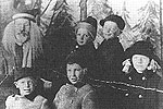
Figure
2: Visiting Santa, the Boston Store, northwest corner of State
and Madison, 1910. »
|