| Views
of the Fair |
1
of 16 next » |
 |
| Illustrated
map of fairgrounds |
1
of 16 next » |
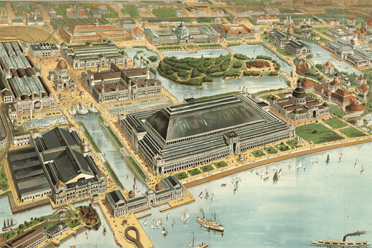
This illustrated map provides a good overview of the fairgrounds, although it does crop off the Anthropology section to the South, the Midway to the West, and many of the State and Foreign Buildings to the North. You can take a virtual tour of the Columbian Exposition using an interactive version of this map.
American Memory Project, Library of Congress. Further reproduction or distribution is prohibited without permission. |